ArkeoGIS
Platform for sharing spatialized datasets on the past (archaeology, (paleo)environment)
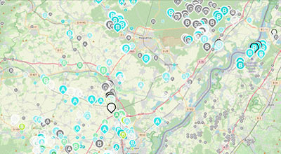
All shared work/databases are accessible and queryable online (webGIS) by ArkeoGIS users.
Each user has a customizable project space. They can query all or part of the available databases online, display their results on several map backgrounds, archive and export their query results to other tools.
The multi-chronology system of ArkeoGIS makes it possible to aggregate, for different regions, information from prehistory to the present day. The spatial coverage of ArkeoGIS allows information to be displayed for all regions. To date, the best informed regions are the Upper Rhine, the Mediterranean basin and the Near East.
Institutional Partners
Project’s holder
ArkeoGIS aggregates about a hundred data sets. It is scientifically supported by Loup Bernard (University of Strasbourg, CNRS UMR 7044) assisted by Jean-Philippe Droux (IR UMR 7044) and Mohammed Benkhalid (AI UMR 7044).
As a member of the MASA consortium, ArkeoGIS participates in the dissemination and implementation of the FAIR principles (Findable, Accessible, Interoperable, Reusable) in the archaeological community.
The ArkeoGIS project is supported by the University of Strasbourg.
Hosted by HUMA-NUM, ArkeoGIS is a sustainable solution.
Objects
ArkeoGIS can be used for any individual or collective research work. Among other things, it can be used to manage part of the DMP (Data Management Plan) of research contracts and is a powerful tool for the preparation of research. The data and the application are perpetuated thanks to the TGIR HUMA-NUM.
Several tens of thousands of sites, objects and analyses are accessible.
Presentation
ArkeoGIS allows :
– A qualified import
Import your data guided by the online correction assistance, add metadata (in DublinCore) and obtain interoperable data.
– Interactive mapping
What? Where? When? By whom? Discover and query multidisciplinary spatial datasets, for a state of the art search of shared data...
– a standardised export
Export the results of your research in a standardised format (CSV / XML) for direct re-use in the tools of your choice: spreadsheet, QGIS, R... and formatted on Pactols (Opentheso) and AAT (Getty Research Institute).
– Presence of a rich and varied thesaurus connected to a controlled and standardised vocabulary (Opentheso)
– a personalised interface
A personalised space, to choose your chronologies, languages, databases, terms and work area from the set of data pooled in 4 languages.
– a data dissemination
Disseminate the level of information of your choice, and make it accessible in the community of qualified users by indicating how to cite you while obtaining a DOI via NAKALA.
– Perpetuation
Perennial DOIs for storage (via the Nakala repository), ARKs (Archival Resource Keys) for terms used, secure and duplicate hosting for long-term preservation.
Map backgrounds and datasets are accessible to all users and can be implemented on demand, via user communities
Databases: https://arkeogis.org/manual/databases/
Maps: https://arkeogis.org/manual/cartographic/
Partner institutions :
University of Strasbourg https://www.unistra.fr/
MASA Consortium https://masa.hypotheses.org/
Web links :
ArkeoGIS website : https://arkeogis.org/en
Users : https://arkeogis.org/users
Data import : https://arkeogis.org/manuel/import-2
Metadata : https://arkeogis.org/manual/metadata
Manual : https://arkeogis.org/manual
Bibliography:
Loup Bernard. Ten Years of ArkeoGIS: Feedback on the Challenges and Benefits of Digitally Sharing Archeological Data. Workshop #2 DARIAH-CH, 2019, Neuchatel, Switzerland. ⟨hal-02865759⟩.